- Download:
- MP3 (spielt überall)23 MB
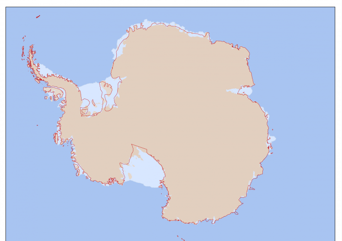
Auf dem Hackweekend in Karlsruhe haben wir Jochen Topf und Christoph Hormann zu Ihrem Projekt „Antarctica“ interviewt. Zusammen wollen sie die Kartierung unseres südlichsten Kontinents verbessern und dazu u.A. neue Küstenlinien importieren. Über ihre Motivation, Pläne und die Probleme denen sie dabei gegenüberstehen berichten sie in dieser Spezialausgabe des Radio OSM.
Vorstellung
- Blog von Jochen
- Blog von Christoph
- Osmium
- Taginfo
- Imagico – Views of the Earth
- OpenStreetMapData.com
- osmcoastline
- Küstenlinien-Generalisierung
Aktueller Stand
- Insel wird zur Halbinsel
- McMurdo Station
- Arctowski-Station
- Base Presidente Eduardo Frei Montalva
- Station Concordia
Datenquellen
- GADM Global Administrative Areas
- MODIS Sensor
- Mosaic of Antarctica (MOA)
- Landsat Image Mosaic Of Antarctica (LIMA)
- NASA’s BlueMarble NG
- Coastline in OSM
Geografie
Tagging & Bearbeiten
- Größenvergleich Antarktis und Europa
- Mercator Projektion
- Antarctic Polar Stereographic Projection
- Stereografische Projektion
- Potlatch 2
- iD Editor
- JOSM
- Wiki: Antarctica
- Wiki: Antarctica Import
Wie geht’s weiter?
- Artikel bei Jochen und Christoph
- imports Mailingliste
- Kommentarseite im Wiki
- Webkarte in Antarctic Polar Stereographic Projektion
Music by Dan-O at DanoSongs.com
http://danosongs.com/danosongs.com-license.pdf (Title: Remember how it started)


Pingback: OSM podcast interview on Antarctica | Imagico.de